
")
By Dr. Curtis Varnell
What could be better than a warm spring day and a beautiful and historical place to explore. The waters of the Arkansas River spoke a melodious tone as it rushed below the dam, tumbling over submerged snags and lapping against the wide sand bar that fronted both sides of the river at Dardanelle. Scattered groups of people threw weighted lines into the waters, hoping to snag some of the large catfish known to inhabit the area. Others sat around campfires built on the sandbar, bringing back memories of the days I spent with my family doing the same things.
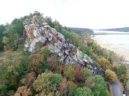
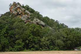
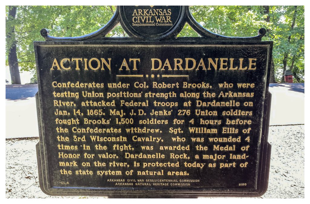
Towering over the site, Dardanelle rock juts upward hundreds of feet into the air. A small but steep trail allows access to the exposed sandstone overlook. Historically, the cliff face was a marker for both natives and early settlers and was used bylookouts scouting the river during the Civil War. The old ferry to Norristown (Russellville) was located just below the rock and it was used by armies of both sides as they traversed the state. A nearby marker notes Sgt. William Ellis was awarded the Congressional Medal for the heroism he displayed during an 1865 battle in Dardanelle.
A romantic, but probably non-historical tale, cites that the rock was so named when a Cherokee brave by the name of Dardanelle stood on the rock awaiting a sign from his Choctaw lover Leonietta that she would join him. When she failed to appear, he jumped to his death below and the rock was thus named for him. More likely, the craggy cliff was named after the ocean passageway found in Asia-Minor or after Jean Baptiste Dardenne, an early French land-owner.
A short distance downstream is the Council Tree. A huge white oak, estimated to be 400-500 years old is said to be the site of the signing of a document referred to as the “Treaty of Council Oaks.”
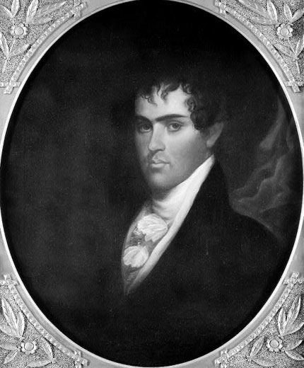
On June 24, 1823, Acting Governor Robert Crittenden of the Arkansas Territory meet with a group of Arkansas Cherokee to work out a land agreement that would allow settlers to move into the western part of the state. Previous treaties had provided substantial territory in Arkansas and Oklahoma to the tribe in exchange for lands they were driven from in the East. Although land south of the Arkansas River technically belonged to the Choctaw, over 1,000 Cherokee occupied prime farm lands along the river tributaries. Meeting with Cherokee leaders including John Jolly, Black Fox, and Wat Webber, the group actually had little or no authority to construct a treaty but were able to dictate a letter presenting their respective cases to Secretary of War John C. Calhoun. The Cherokee agreed that the land south of the river was not theirs or the U.S. but, instead belonged to the Choctaw, who didn’t care one way or another whether it was occupied by Cherokee. The U.S. Government at the time wanted to see all land opened up to white settlement and in subsequent years worked out a series of treaties pushing the Cherokee and the Choctaw completely into Oklahoma territory. A nice park was constructed around the tree commemorating the event.
A town marked by historical events, the city is now billed as the fictional starting site for Mattie Ross as she begins her adventures in the movie True Grit.
My wife cares little for the history lesson. As I set and contemplate the cultural and historical significance of the area, she wonders up the beach with my son Lucas, enjoying splashing in the water and discovering unusual rocks along the path.


