

Historians are always checking out cemeteries and old gravestone to discover history but one little expects to stumble across those stones right in the middle of a state park! Yet, there they sat, two stones side by side right in the middle of Dardanelle state park inscribed with weathered lettering designating the life and death of William Lovely and his wife Persis.
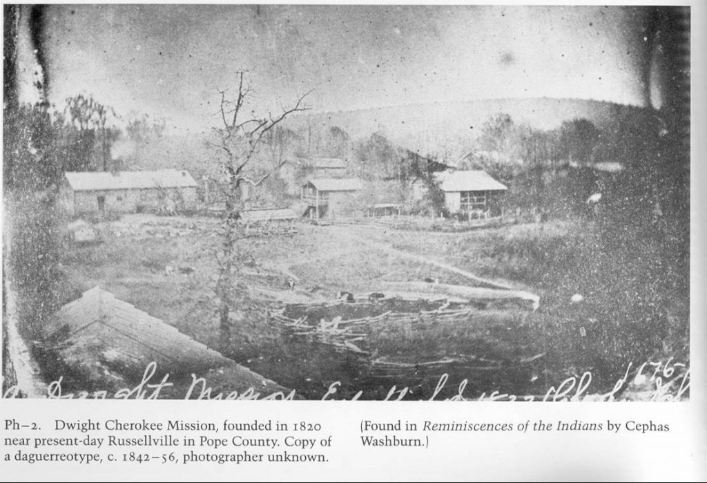
Little known today, the choices made by Lovely greatly influenced, not only the development of the River Valley, but of all the western frontier. A migrant from Dublin, Ireland, Lovely arrived in what was to become the U.S. just in time to fight in the Revolutionary War. He rose to the rank of Captain and was provided some 4,000 acres of bounty land for his service. Settling in Tennessee, he was appointed a position as an agent to the Cherokee tribe. In 1809, in order to prevent problems with settlers, many of the Cherokee requested and were given land in the new Louisiana Purchase and settled in an area along the Arkansas River from around Morrilton into present day Oklahoma. The chief and many leaders lived in an area around Spadra (Clarksville) and eventually Dwight Mission, a religious school for Cherokee children, was established near present day Russellville. William Lovely and his wife, as Indian agents, set up his home close to the mission on the east bank of the Illinois Bayou. Other tribes were assigned land in western Arkansas as well, resulting in a virtual Indian territory that extended west to the Rockies.
Located 300 miles from the nearest post office, Persis described the site as lonely, desolate, and dangerous. Her few neighborsand friends included the Witts, the Stinnetts (Stinnetts Station), Kirkbridge Potts (Pottsville), and the more famous Raven (Sam Houston) who was married to Cherokee Chief John Jolly’s daughter.
From the beginning, the western Cherokee clashed with the Osage tribe of north Arkansas. Violent warfare between the two groups threatened peace on the frontier. In 1815, Lovely came up with a plan to prevent this warfare, he purchased some three million acres of land from the Osage to serve as a border between the two tribes. Called the Lovely Purchase, this land included what is now Washington, Madison, and a portion ofCrawford County as well as a big part of eastern Oklahoma extending nearly to Tulsa.
At the time, there was no western boundary to Arkansas. As settlers began moving into western Arkansas, infighting between the various Indian tribes created a necessity to establish a western border. In Scott county, settlers and Choctaw eventually settled on a border along the Poteau River. North of that, a huge diamond shaped area of Arkansas extended far into what is now Oklahoma and the river valley was Cherokee Nation land. In 1928, to prevent clashes with settlers, the Cherokee gave up rights to all land in the River Valley to a straight line running from the western border of Missouri to the Arkansas River in exchange for Lovely’s Oklahoma Purchase. The boundaries of the state as we now know it was established by this little known individual, buried alongside his wife and a small adopted Indian girl, at our own Lake Dardanelle State Park.
Who knows, without him we might be talking about Clarksville, Indian Territory and Tulsa, Arkansas and the complete history of the Arkansas River valley would be forever altered.


